Ocean Dynamics and the Future of Tropical Tuna Governance
Tuna fisheries play a critical role in the global blue economy, supporting food security, coastal livelihoods, and international seafood markets. Effective governance of these highly migratory species requires a deeper understanding of the oceanographic processes that shape their distribution. This article examines how dynamic ocean features such as Sea Surface Height (SSH), ocean circulation, and seasonal upwelling significantly influence tropical tuna habitats, often beyond what conventional indicators like sea surface temperature and chlorophyll can capture. Drawing on recent research from the eastern Indian Ocean, the study highlights the importance of integrating dynamic oceanographic indicators into fisheries management frameworks. It further discusses the implications of shifting tuna distributions for Regional Fisheries Management Organizations (RFMOs), global fisheries governance, and climate adaptation strategies. By incorporating ocean dynamics into predictive systems, fisheries management can move toward more adaptive, ecosystem-based governance that supports both sustainability and equitable resource access in a changing ocean.
Tuna in the Global Economy and Food Security
Tuna fisheries occupy a central position in the global blue economy. Tuna supports coastal livelihoods, sustains international seafood markets, and contributes significantly to global food security1,2. For many developing countries, tuna is not merely an export commodity but a strategic marine resource closely linked to economic stability and maritime sovereignty. Its governance therefore intersects ecological, economic, and geopolitical dimensions.
The Food and Agriculture Organization (FAO) consistently identifies tuna as one of the most valuable and widely traded marine resources. Because tuna species are highly migratory, their management falls under Regional Fisheries Management Organizations (RFMOs) such as the Indian Ocean Tuna Commission (IOTC) and the Western and Central Pacific Fisheries Commission (WCPFC). These institutions are responsible for balancing conservation priorities and economic interests across jurisdictions. Their effectiveness depends heavily on the quality of scientific knowledge that informs decision-making3.
However, a fundamental question remains: how well do current management systems understand the environmental drivers that shape tuna distribution? Many fishing ground prediction systems still rely on sea surface temperature and chlorophyll concentration4,5. These indicators are important and readily accessible, yet they primarily describe surface conditions. Tuna, however, respond to much more dynamic oceanographic processes.
Pelagic predators move along energy gradients shaped by ocean circulation, mesoscale eddies, and upwelling systems. These physical processes influence nutrient transport and prey aggregation across wide spatial and temporal scales. As climate variability intensifies, these dynamics become increasingly important. Management systems that rely solely on surface indicators risk oversimplifying this ecological complexity.
The Role of Oceanographic and Seasonal Dynamics in Tuna Distribution
Research conducted at the Faculty of Fisheries and Marine Sciences, Universitas Padjadjaran (FPIK UNPAD), examined the habitat distribution of skipjack tuna in the eastern Indian Ocean using an integrated modelling approach6. By combining multiple analytical methods and oceanographic parameters, the study aimed to represent environmental variability more comprehensively. This approach reflects a broader shift toward ecosystem-based fisheries management in modern fisheries science. The objective is not only to predict fishing locations but also to understand the processes that shape them.
One consistent finding is the significant role of Sea Surface Height (SSH) in explaining habitat suitability6,7. SSH is closely associated with ocean circulation, mesoscale activity, and the formation of frontal zones8. These processes influence nutrient enrichment and prey concentration within pelagic ecosystems. In this sense, SSH represents the structural and dynamic characteristics of the ocean rather than simply surface conditions.
Seasonal habitat expansion patterns are also closely linked to monsoon-driven upwelling systems in the eastern Indian Ocean. Upwelling enhances nutrient availability and strengthens trophic pathways that support tuna populations. This phenomenon is not unique to a single region but occurs in many tropical upwelling systems worldwide. It illustrates how atmospheric forcing and ocean physics jointly shape fisheries productivity.
Implications for Global Governance and RFMOs
These findings carry important implications for global tuna governance. RFMOs rely on assumptions about stock distribution when establishing quotas, conservation measures, and monitoring frameworks. When environmental variability shifts habitat boundaries, access and catch composition may also change. Integrating dynamic oceanographic indicators into stock assessment frameworks can therefore enhance the adaptive capacity of fisheries management.
There is also a subtle geopolitical dimension to these dynamics. Shifts in tuna distribution may influence which coastal states benefit more from seasonal abundance, potentially affecting negotiations within RFMO forums. As stocks move in response to environmental variability, issues of allocation fairness and resource access become increasingly relevant. Strengthening the scientific basis of habitat prediction can help reduce uncertainty in these discussions and promote more transparent decision-making.
Relevance to Climate Change and the SDGs
Climate change further complicates this situation. Rising ocean temperatures, changing circulation patterns, and increasing marine heatwaves are reshaping pelagic ecosystems. Static interpretations of habitat are becoming less capable of capturing emerging distribution dynamics. Governance systems must therefore evolve alongside these environmental changes.
More comprehensive habitat predictions also have operational implications. Improved spatial guidance can reduce search time for fishing fleets and lower fuel consumption4. This indirectly contributes to reduced carbon emissions and improved economic efficiency. In addition, a more balanced spatial distribution of fishing effort can help prevent excessive pressure on specific fishing grounds.
The integration of dynamic ocean indicators aligns closely with the Sustainable Development Goals. SDG 14 emphasizes science-based and ecosystem-oriented fisheries management. SDG 13 highlights the importance of adapting to climate variability and environmental change. SDG 12 underscores responsible and efficient production systems.
Towards Ocean Dynamics-Based Fisheries Management
For institutions such as FPIK UNPAD, regional research becomes globally relevant when it addresses shared governance challenges. Scientific findings from the eastern Indian Ocean can enrich discussions within FAO and RFMO platforms. Cross-regional learning strengthens collective resilience in the face of environmental change. Evidence-based adaptation must become a core component of marine policy.
Ultimately, tuna governance is not solely about monitoring and compliance. It is about understanding how physical ocean processes create ecological opportunities. Tuna follow circulation pathways, energy gradients, and trophic structures shaped by ocean dynamics. Effective governance must therefore move in the same direction.
In an increasingly dynamic ocean, predictive systems must reflect structural variability rather than static averages. Integrating indicators such as Sea Surface Height into fisheries management frameworks represents a step toward a more comprehensive understanding. This approach does not replace traditional indicators but complements them. The future sustainability of tropical tuna depends on a broader oceanographic perspective.
References
1. Bell, J., Senina, I., Adams, T., Aumont, O., Calmettes, B., Clark, S., Dessert, M., Gehlen, M., Gorgues, T., Hampton, J., Hanich, Q., Harden?Davies, H., Hare, S., Holmes, G., Lehodey, P., Lengaigne, M., Mansfield, W., Menkes, C., Nicol, S., Ota, Y., Pasisi, C., Pilling, G., Reid, C., Ronneberg, E., Gupta, A., Seto, K., Smith, N., Taei, S., Tsamenyi, M., & Williams, P. (2021). Pathways to sustaining tuna-dependent Pacific Island economies during climate change. Nature Sustainability, 4, 900 - 910. https://doi.org/10.1038/s41893-021-00745-z.
2. McCluney, J., Anderson, C., & Anderson, J. (2019). The fishery performance indicators for global tuna fisheries. Nature Communications, 10. https://doi.org/10.1038/s41467-019-09466-6.
3. Heidrich, K., Juan-Jordá, M., Murua, H., Thompson, C., Meeuwig, J., & Zeller, D. (2022). Assessing progress in data reporting by tuna Regional Fisheries Management Organizations. Fish and Fisheries. https://doi.org/10.1111/faf.12687.
4. Sativa, D., Putra, M., & Marini, I. (2025). Correlation of Oceanographic Parameters with Yellowfin Tuna Catch in Fisheries Management Areas (WPP) 573 and 713. Jurnal Biologi Tropis. https://doi.org/10.29303/jbt.v25i1.8794.
5. Arta, F., Mubarak, M., & Nasution, S. (2024). Analysis of chlorophyll-? and sea surface temperature distribution using satelite image to estimate of fishing zones for yellowfin tuna (thunnus albacares) in West Sumatera Province Waters. Asian Journal of Aquatic Sciences. https://doi.org/10.31258/ajoas.7.1.8-18.
6. Pratama, G. B., Wijayanti, L. A., Maqbul, I., Muhyun, A. A., Sahar, R. A., Ayu, R. G. & Firdaus, M. R. (2025). Multi-algorithm species distribution modeling for skipjack tuna fishing grounds detection in the Indian Ocean: a case study of Indonesian FMA 572. Environmental Quality Management, 35: 70166. https://doi.org/10.1002/tqem.70166.
7. Yati, E., Sadiyah, L., Satria, F., Alabia, I. D., Sulma, S., Prayogo, T., Marpaung, S., Harsa, H., Kushardono, D., Gaol, J. L., Budiarto, A., Efendi, D. S. & Patmiarsih, S. (2024). Spatial distribution models for the four-commercial tuna in the sea of maritime continent using multi-sensor remote sensing and maximum entropy. Marine Environmental Research. 198. https://doi.org/10.1016/j.marenvres.2024.106540
8. Semedi, B., H. Hardoko, C. S. U. Dewi, N. D. S. Syam’s, N. F. Diza, and G. D. A. P. Bayuaji. (2023). Seasonal Migration Zone of Skipjack Tuna (Katsuwonus pelamis) in the South Java Sea Using Multisensor Satellite Remote Sensing. Journal of Marine Sciences, 2023: 1–4. https://doi.org/10.1155/2023/1073633
(The views expressed are those of the author and do not represent the views of CESCUBE)
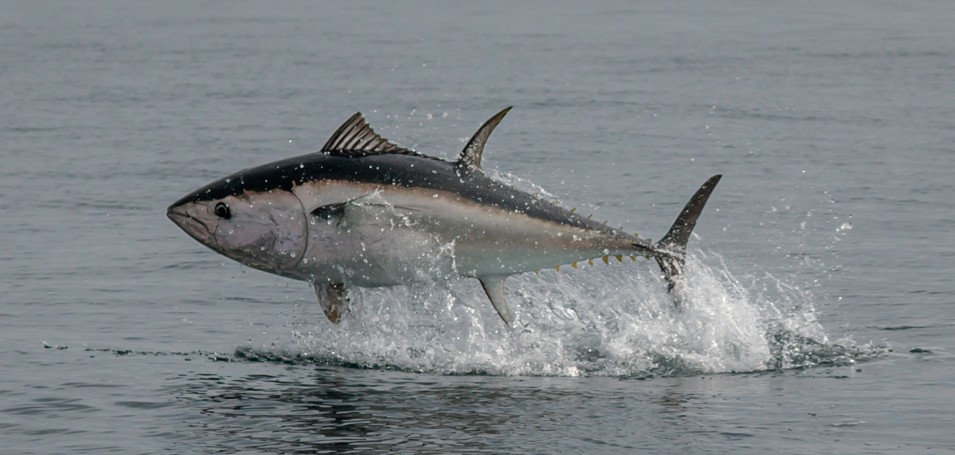
Photo by Ray Harrington on Unsplash