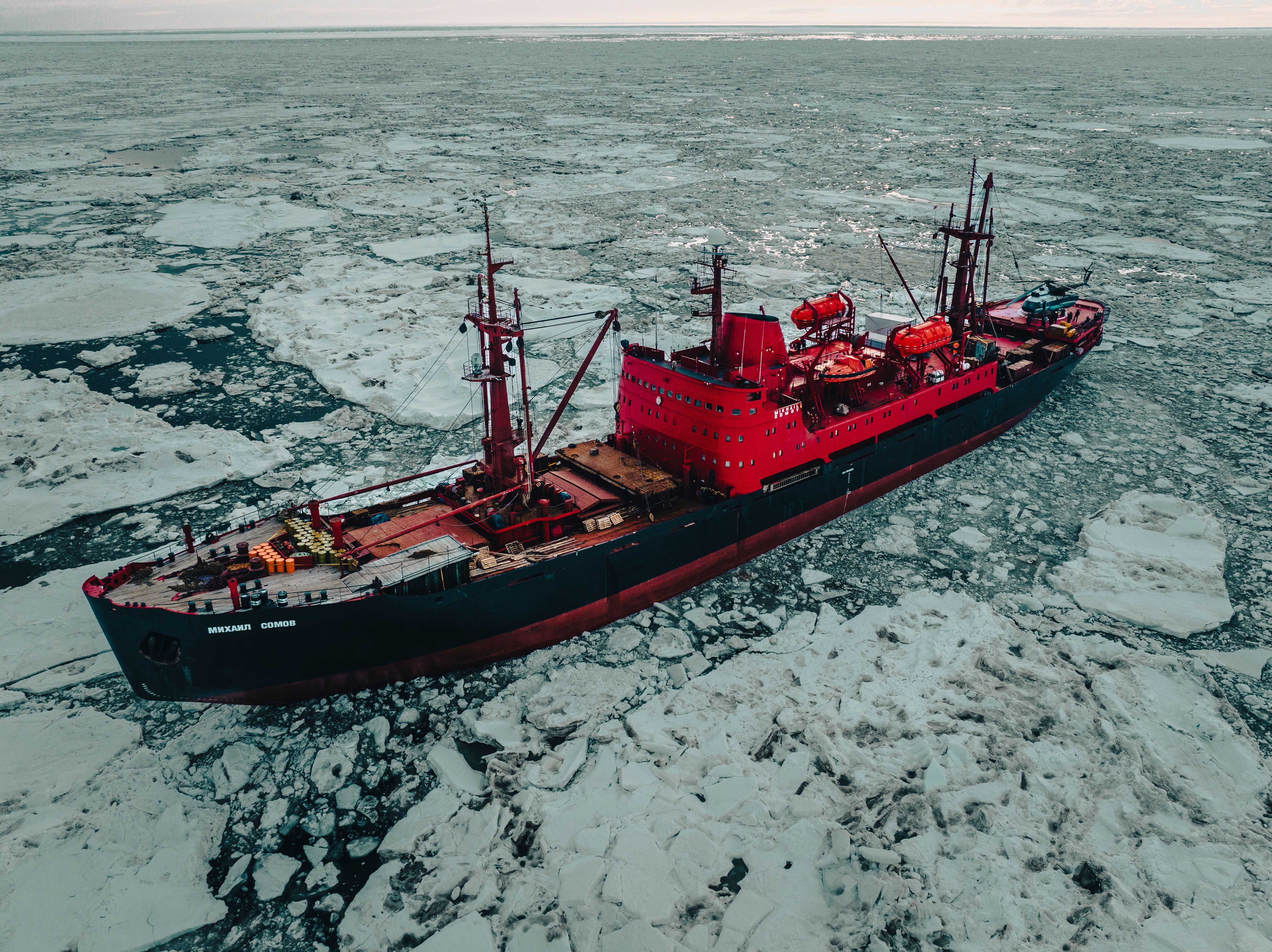
China’s adventures in deep-sea mining
In the oceans, at a depth of as low as 5000 meters, there lie the critical minerals for the usage of modern societies starting from smartphones to electric cars to green energy. Oceans provide an alternative to land-based resources as they are getting depleted or getting more challenging to access. In certain parts of the ocean, these minerals are available in much more quantity than in the land-based reserves. The minerals can also be considered as the new ‘Gold Rush’, where the race is to mine the precious minerals buried in the seabed.
Generally, four types of mineral resources can be found in the deep sea:
1. Liquid and Gaseous substances like petroleum, helium, condensate, carbon dioxide, and nitrogen.
2. Ore-Bearing silts and brines which contain various minerals like zinc, copper, and iron. These minerals are generally found at depths which are greater than three meters.
3. Other useful minerals in the form of siliceous and calcareous oozes, phosphorite, and manganese nodules, which occur on the sea-surface or at a depth less than three meters.
4. Cobalt-rich crusts and polymetallic nodules are also found but very difficult to access as are loosely scattered across the seafloor in the areas around the volcanic region.
The deep-sea region is vast, and till date, only a few areas are explored, and based on the current level of understanding and technological feasibility, five areas have been identified which are rich in mineral deposits. These five promising regions are the Pacific area in the US exclusive economic zone (EEZ) around the Hawaiian Archipelago, the Clarion-Clipperton area in the Pacific Ocean, the South Pacific area, the Red Sea area, and the Central Indian Ocean Basin.
The minerals in the deep-sea ocean, which are accessible as per the current technological feasibility, are the ‘Manganese Nodules.’ They contain vast amounts of other minerals like copper, nickel, and cobalt. The international community also started looking forward to the commercial and economic benefits of these mineral resources. To utilize newly discovered minerals, the UN came forward and took responsibility for the management of mineral resources in the deep seas.
As the seabed minerals have huge potential and are capable of boosting the economy, various countries were attracted towards them. The developing countries were concerned that, as the developed countries are far more technologically advanced, they might try to capture the majority of the mineral resources under their ambit, which can later lead to potential power struggles as well. Therefore, “The General Assembly unanimously adopted Resolution 2340 (XXII) on December 18, 1967, which recognized “the common interest of mankind in the seabed and the ocean floor, which constitute the major portion of the area of this planet.” In the resolution, the UNGA (United Nation General Assembly) declared that:
“The exploration and use of the seabed and the ocean floor, and the subsoil thereof should be conducted in accordance with the purposes and principles of the Charter of the United Nations, in the interest of maintaining international peace and security and for the benefit of all mankind.”
After the rounds of consultations and negotiations between the developed and developing countries, the original rules for the deep seabed mining in an area, i.e., the draft UNCLOS (United Nations Convention on the Law of the Sea), were finally passed. The ISA (International Seabed Authority) was established as the main governing body of the deep seabed mining under Article 153 of the UNCLOS. All the member states which have signed the convention are also members of ISA. The ISA is responsible for administering deep seabed activities and promulgating rules and regulations regarding the exploration and exploitation of deep seabed minerals. ISA regulates all the parties which are involved in the deep-sea mining activities and keeps an eye that whether all the rules and regulations like the protection of biodiversity, marine environment, and others are being followed properly or not.
In deep seabed mining, three stages are involved; prospecting, exploration, and exploitation. As per the laws, prospecting can be conducted only after the ISA receives an agreement stating that the proposed prospector will comply with all the rules, regulations, and procedures established by the ISA. Exploration, which is followed by the last stage, i.e., exploitation, can be carried only in the areas which are specified and approved by the ISA in accordance with the laws, rules, and regulations.
The applicants have to obtain the certificate of sponsorship from the state before signing any contract for the exploration and exploitation in the deep seabed with the ISA. “Article 139(2) and 153(4) of the UNCLOS provide the legal basis for the sponsorship of States parties”. The International Tribunal for the Law of the Sea (ITLOS) gave the advisory opinion regarding the various legal responsibilities which the sponsoring state has to comply like the Environmental Impact Assessment (EIA), proper administrative measure, and others. In case of any failure, the sponsoring states would be liable for the damages.
Chinese advancement in the deep seabed mining:
China also hopes to play a leading role in the drive of extracting metals from the ocean floor. So far, China has received four of the 29 deep-sea exploration contracts issued by the International Seabed Authority, which are the maximum that any country has received. The contract has also allocated the surface area of nearly 73 thousand square kilometres of the ‘Clarion Clipperton fracture zone’ in the Pacific Ocean.
In the 1990s, China established COMRA, State Oceanic Administration, which functions as an agency for the administration of deep seabed activities. COMRA is the major contractor that is sponsored by the Chinese Government, which engages in the process of exploration and exploitation of resources in the area.
COMRA signed its first contract for exploration in the year 2001 for the exploration of polymetallic nodules and preferential right for exploitation in the Clarion-Clipperton Fracture Zone in the northeast Pacific, which is as big as the size of continental US. It signed two more contracts for the exploration of cobalt-rich ferromanganese crusts and polymetallic sulphides with the ISA.
The growth and success of Chinese deep seabed mining can be divided into three stages:
1. 1980 – 1991: This period dates back prior to the establishment of COMRA. During this period, the four institutions of the state were responsible for the seabed exploration, exploitation, and refining process. During this decade, China worked intensively on developing the research and development required for the investigation, exploitation, processing, and transportation.
2. 1991-2000: COMRA establishment was the cornerstone event for the Chinese deep seabed mining initiatives, as once it got established, China could apply for the research programs, contracts in the seabed mining technology. By the year 2001, Beijing was capable of processing around “one ton of nodules per day and attain metallic elements, including cobalt, nickel, copper, and manganese.”
3. 2001- present: During this period, China gained four more contracts as well for the seabed mining across the Indian and the Pacific Ocean, for the exploration and exploitation of mineral resources ferromanganese crusts, like polymetallic sulphides and polymetallic nodules.
At present, China has developed the equipment for conducting the deep-sea survey for better efficiency. In 2012, a Chinese vessel manned submersible Jiaolong dived 7000 meters in the Mariana Trench. Other vessels like “the unmanned remote-controlled Hailong and unmanned Qianlong” has the capability of descending 6000 meters below the surface of the ocean and exploiting the area of around 500 meters below the sea surface.
As compared to the international standards and other technologically advanced countries of the world like Japan, Germany, and others which are capable of conducting the mining tests at over 2000 – 6000 meters below the sea surface, China is capable of conducting exploitation test to around 500 meters below the sea surface. By the end of 2020, China is aiming to conduct the tests at a depth of 1000 meters below the seabed.
China has also adopted a legislation for deep seabed mining and the protection of the environment, named the “Law of People’s Republic of China on Exploration and Exploitation of Deep Seabed Area Resources,” which came into effect in May 2016. The law aims to standardize all the procedures for the contractors which are engaged in the deep seabed mining activities and state that all the activities must be in line with the specified rules and procedures of the sponsored states, the International Seabed Authority, and the potential contractors. The law also incentivizes the contractors to practice the country’s environmental laws, and other common incentive practices would also be followed, which include government purchases, tax deductions, and Government-sponsored debt for the parties engaging in deep-sea mining activities.
Military Applications:
China is currently operating the largest fleet of research and survey vessels. According to the Asia Maritime Transparency Initiative (AMTI), which works under the Washington based Centre For Strategy & International Studies (CSIS), the Chinese Government currently operated 25 research and survey vessels. The governments of the US, Japan, India, and Australia operate 10, 6, 4, and 3 vessels, respectively. As China is ramping up the research activities in the Indo-Pacific, especially in the South China Sea, many countries have raised issues about China using seabed mapping for military purposes.
In April 2020, China has released a list of around 80 topographical features in the South China Sea, out of which 55 are underwater features like underwater canyons, seamounts, and others in the Chinese language. Most of these features mapped by China are part of Vietnam’s exclusive economic zone. Some experts say that the naming of these features by China is purely symbolic, but this act can be part of China’s traditional psychological warfare. China could be trying to assert its claim on the disputed maritime territory by showing its knowledge about the under-sea cartography, which other claimant countries are lacking. These pressure campaigns also allow China to engage the other claimant countries in these petty disputes and to keep other littoral states from exploring and exploiting these deep-sea resources. In June 2020, the Hai Yang Di Zhi 9, which is operated by China’s Geological Survey, was surveying the Pratas atoll. Pratas atoll is located in the Northeast of the South China Sea and is occupies by Taiwan. China claims it as a part of its territory. In the same month, another Hai yang Di Zhi vessel explored the sea bed of Vietnam’s EEZ. In 2019 also, a controversial survey was done by Hai Yang Di Zhi 8, which led to a military standoff between China and Vietnam. By doing this muscle-flexing in the disputed EEZs of the other claimant countries, where it cannot go for exploitation itself, it tries to stop these nations from exploring and exploiting the resources.
These bullying campaigns of China are not limited to the South China Sea only. In March 2020, Australia spotted the Xiang Yang Hong 1 vessel, operated by the Ministry of Natural Resources of China, near its Christmas Island in the Eastern Indian Ocean. Australia even accused China of mapping the potential routes for its submarines to avoid detection. In August 2019, the Indian Navy expelled the Shiyan-1 vessel of China from its territory. It was performing mapping activities near the Andaman and Nicobar Islands. The Shiyan type vessels are operated by China’s Institute of Underwater Acoustics and are equipped with advanced sensors, sonars, and other equipment. These are capable of precise mapping of the topographic features on the seabed. This poses a severe threat as this allows China to use this underwater cartography to chart safe routes for its submarines. With a knowledge of the underwater topographic features, China can use this data so that its submarines can go undetected.
Environmental concerns:
The ‘International Seabed Authority’ is still in the phase of writing and modifying the regulations, but a major part of the mandate aims to minimize the environmental harm, but the majority of the researches conducted by various scientists’ body are concerned that the commercial contracts of mining can damage the environment. The seabed is still a mystery for mankind, and not much of the cause and effect relationship is known yet. Due to the newly developed attention of the ‘technology- hungry’ world towards mineral resources in the deep seabed, the scientists and environmental organizations are concerned that this can lead to a whole new level of environmental degradation.
The ISA, which is mandated with the responsibility of handling all the seabed activities, is ill-equipped and has turned into a license distributing agency. The agency is still framing the Mining Code, which will set the rules for the commercial extraction of the seabed minerals. The ISA has estimated that the large-scale extraction of seabed minerals for commercial purposes will be feasible only by 2027.
The environmental concerns of the seabed mining to the marine ecosystem are yet to be analysed, but the DISCOL Test, which was conducted in 1989 in an 11 Km plot in the Pacific Ocean, shows that the area hasn’t recovered even after 30 years. Hjalmar Thiel, the ecologist who organized the DISCOL test, noted that “The disturbance is much stronger and lasting much longer than we ever would have thought.”
Way Forward:
Seabed mining has the potential to initiate a new race for resources. This, in turn, can initiate new conflicts and disagreements. In many cases, maritime boundaries issues between various countries are not yet resolved. Due to the disturbances followed by mining activities in the deep seabed, many species can go endangered and eventually extinct. At the time, when the international community is struggling to avert the catastrophic effect of global warming and climate change, another risk of disturbing the ecosystem is not worth taking, even if it is commercially viable. The process of seabed mining must only begin with the increased scrutiny and an extensive alliance of all the stakeholders, including the international organization, national Government, potential contractors, scientific community, and non-governmental organizations. The mechanism developed by the ISA must have proper third-party checks to maintain transparency and avoid any harm to the marine ecosystem.
Notes:
1. “The Seabed and the Ocean Floor on JSTOR.” n.d. Accessed November 13, 2020. https://www.jstor.org/stable/40704571’seq=1.
2. “China’s Deep-Sea Mining, a View from the Top.” n.d. Accessed November 12, 2020. https://chinadialogueocean.net/10891-china-deep-sea-exploration-comra/.
3. “China’s Deep-Sea Mining, a View from the Top.” n.d. Accessed November 11, 2020. https://chinadialogueocean.net/10891-china-deep-sea-exploration-comra/.
4. “Stop Seabed Mining Now.” n.d. Accessed November 14, 2020. http://cimsec.org/stop-seabed-mining-now/44794.
Pic courtesy- Vlad Tchompalov at unsplash.com
(The views expressed are personal.)

Nikita Vats is the Managing Editor at the Centre for Security and Strategy Studies (CeSCube). She is the co-founder of the Centre for New Age Warfare Studies (CNAWS). She is a PhD candidate at the Jindal School of International Affairs, O.P. Jindal Global University, India. She previously served as a Research Associate at the National Maritime Foundation, where she contributed to maritime and strategic policy research. She holds a B.Sc. (Hons.) in Chemistry from the University of Delhi and an M.Sc. in Chemistry from Panjab University. She also holds a Master's degree in Political Science and International Relations. Her research interests span traditional and non-traditional security issues and strategic affairs.